Speed as a Strategic Advantage in Border Monitoring
High-frequency satellite imagery and AI analytics are transforming how agencies observe and respond to dynamic border zones.
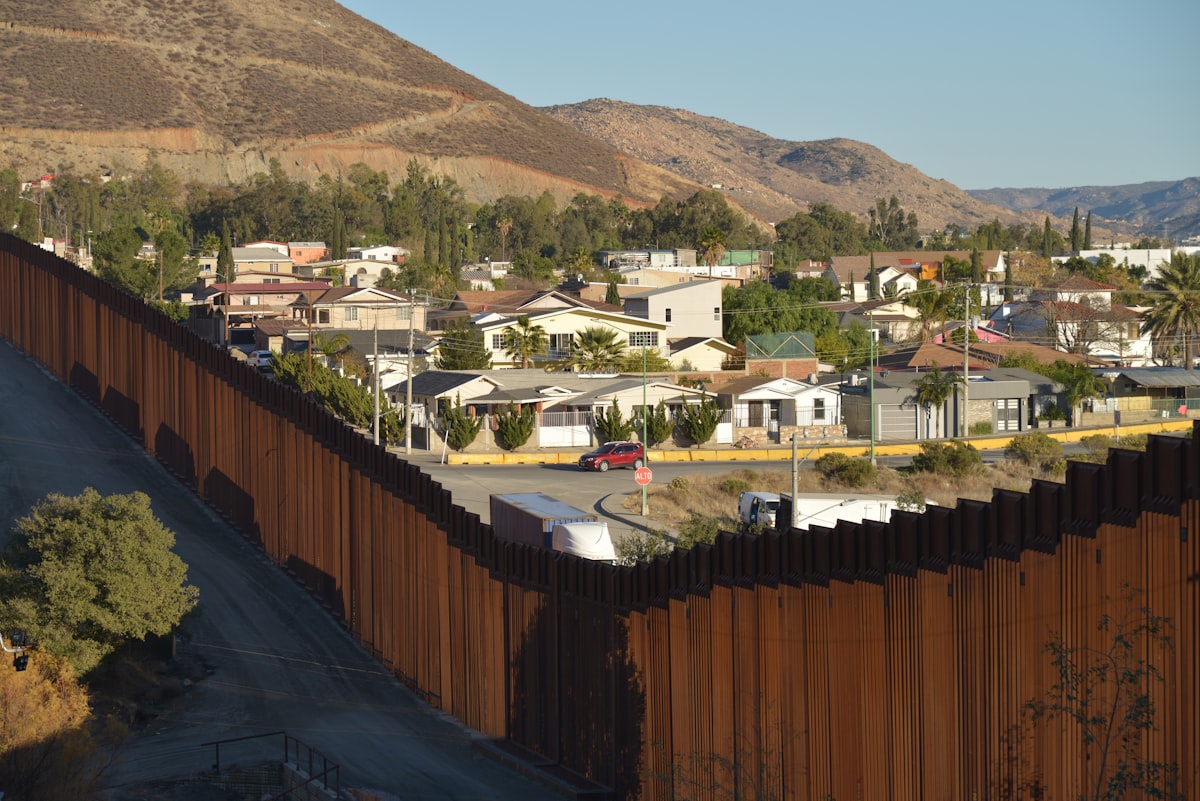
Speed as a strategic advantage in border monitoring
Speed changes everything. As a strategic advantage in border monitoring, it's shifting how security organizations operate across Europe, and it's transforming their entire approach to defense. Border zones are no longer static lines. They're fluid, dynamic systems where activity shifts within hours, vehicles move, staging areas scatter, and small watercraft change routes with little warning. But the hurdle for ministries of interior and security agencies isn't a lack of information. It's the tempo of the environment.
The new reality of border fluidity
Tracking activity in these regions is getting harder. Old, delayed reporting methods just can't keep up. But commercial space-based intelligence now offers a way to maintain pace, so by using high-frequency satellite imagery paired with artificial intelligence, governments are finding ways to compress their decision cycles and act faster than ever before. It's no longer just about seeing a location from orbit. It's about acting on that sight immediately.

Detecting movement at the tactical level
Tactical awareness demands one answer. What is happening right now? Persistent monitoring helps teams identify indicators of organized facilitation networks or emerging crossings, and high-frequency revisit rates allow analysts to distinguish between random movement and deliberate shifts in patterns. Artificial intelligence plays a role here by automatically classifying vehicles, vessels, and aircraft. So this lets human analysts focus on anomalies instead of manual image scanning.
- Concentrations of vehicles near non-transit corridors
- Development of temporary encampments or staging areas
- Aircraft operating in support roles
- Small maritime vessels maneuvering outside established traffic patterns
Operational resource allocation
Operational leadership must decide how to distribute resources across regions over time. It's a tough job. Pattern-of-life analysis is the primary tool for this task, and by watching for weeks and months, commanders can see where vehicle concentrations are rising or which maritime approaches face sustained pressure. This intelligence prevents agencies from waiting for an incident to happen. So they can anticipate shifts and move assets before an area becomes overwhelmed. Speed at this level means shortening the gap between analysis and action.
Shaping long-term strategic posture
Strategic border security aims to reduce uncertainty. Persistent monitoring reveals logistics nodes and infrastructure that support facilitation networks, and these indicators inform broader assessments about how routes evolve over time. So policymakers use this information to prioritize investments and improve coordination across borders. It works. We've found that this approach succeeds because early visibility lets governments shape their posture through better resource prioritization and diplomatic efforts, moving beyond mere reaction.
Accelerating the decision cycle
Modern security demands a level of responsiveness that was previously impossible. But it's now achievable. Technologies like those developed by BlackSky are built to address this need for tempo, and their constellation provides frequent revisits, sometimes on an hourly basis, to keep up with fast-moving environments. So they're a system designed for immediate application. This combines low-latency imagery with automated detection.
Speed is not simply a technical attribute. It is a strategic necessity.
This reality forces a change in how governments view their borders. But decisions based on current conditions, rather than outdated summaries, represent the core advantage in today's security climate. It's a huge shift. When activity changes in an instant, the capability to maintain a clear picture is the difference between a successful intervention and a missed opportunity. So they can't rely on old reports.
Frequently Asked Questions
What is the primary challenge for ministries of interior and security agencies in border monitoring according to the article?
The primary challenge is not a lack of information but rather the tempo of the environment. The article states that activity in border zones shifts quickly, and old, delayed reporting methods cannot keep up.
How does high-frequency satellite imagery paired with AI help in border monitoring?
It helps compress decision cycles and enables governments to act faster. The article explains that by using this technology, governments can maintain pace with fluid border environments and move beyond relying on outdated reports.
Why is speed considered a strategic necessity in border monitoring?
Speed is a strategic necessity because it allows decisions based on current conditions rather than outdated summaries. The article emphasizes that when activity changes instantly, the capability to maintain a clear picture is crucial for successful intervention.
Who uses pattern-of-life analysis to distribute resources across regions over time?
Operational leadership uses pattern-of-life analysis for resource allocation. The article notes that commanders watch for weeks and months to see where vehicle concentrations rise or which maritime approaches face sustained pressure.
What indicators do persistent monitoring systems detect to reveal logistics nodes that support facilitation networks?
They detect concentrations of vehicles near non-transit corridors, development of temporary encampments or staging areas, aircraft operating in support roles, and small maritime vessels maneuvering outside established traffic patterns.

Arthur Vance writes about astronomy and space exploration, covering the discoveries that expand our view of the cosmos. He enjoys connecting distant science to the questions we ask here on Earth.
💬 Comments (0)
No comments yet. Be the first!